Madeira's other Pico Ruivo: the quiet Paul da Serra path volunteers now look after
Madeira has two Pico Ruivos. The quiet one, at 1,640 m on the Paul da Serra plateau, now has volunteers caring for its path. What it is and how to walk it gently.
When people say "Pico Ruivo" they nearly always mean the island's highest peak, 1,862 m, at the end of PR 1 and PR 1.2. But Madeira has a second Pico Ruivo, much quieter and much easier to reach. Pico Ruivo do Paul da Serra stands on the plateau in the west of the island, and this autumn its little path has new carers.
What's new
According to DN Madeira (25 October 2026), the Rotary Club of Funchal and the PortoBay hotel group signed an agreement on 22 September to carry out regular conservation and maintenance on the Vereda do Pico Ruivo do Paul da Serra for the next three years. ("Vereda" is our word for a footpath.) The stated aims are better walking conditions and safety for hikers, and protecting the vegetation and natural heritage along the route.
This builds on a protocol the Rotary Club signed on 6 July 2026 with IFCN (the Instituto das Florestas e Conservação da Natureza, the regional forest and nature agency). It covers the management, improvement, signposting and maintenance of the path, and it appears on IFCN's list of cooperation protocols. The first joint work took place on Tuesday 20 October in the Estanquinhos area, where the walk usually starts. Teams from both organisations went out to clean and look after the path.
Why this matters more than it sounds
From the outside, trail upkeep looks like it simply happens. It doesn't. Madeira's new trail rules, Portaria 595/2026, published on 19 October, make that very clear for classified trails. Whoever applies to classify a trail has to provide a maintenance plan and a carrying-capacity study (how many walkers it can take), then clear obstacles, keep the waymarks and signs in good repair, check safety structures and keep the trail information up to date.
That's a lot of work for every single path. So it's good news when a local club and a local business take on even one short path for three years. IFCN already has similar partnerships for other jobs, such as "Carbon Offset" reforestation protocols with SOU.MADEIRA, Madeira Friends and the Madeira Motorcycling Association.
For us locals there's a simple, honest feeling behind it. We used to treat the mountains as something that would always be there and always be fine. The last few years have shown that paths, signs and fences only exist because someone keeps fixing them.
The place: Madeira's only plateau
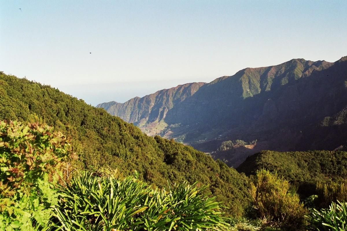
"Paul" means marsh or bog. The name fits once you've seen the plateau after a wet winter, with shallow pools lying in the hollows. Visit Madeira describes Paul da Serra as the only plateau on the island, at an average height of about 1,500 m. On a clear day you can see both the north and south coasts.
IFCN's description of the central mountains explains why the area is protected:
- Water. IFCN calls the Paul da Serra plateau the most important recharge area for Madeira's underground water. In other words, much of the rain that soaks in up here feeds the island's groundwater.
- Protected status. The high mountain areas, including Paul da Serra, are part of the Natura 2000 network (as a Special Protection Area for birds and a Special Area of Conservation) and a regional Natural Monument.
- Recovering vegetation. For centuries, grazing animals badly damaged the plant cover up here. In 2003 the regional government finished removing livestock, and IFCN says the vegetation has been recovering slowly ever since, despite the 2010 wildfires. Above about 1,300 m, IFCN counts around 54 endemic flowering plants. Visit Madeira names the mountain thyme, "alecrim-da-serra" (Thymus micans), as one endemic species you'll find on the plateau.
IFCN gives the summit of Pico Ruivo do Paul as 1,640 m, the high point of the western mountains. Wind turbines line part of the plateau, and IFCN lists wind farms among the infrastructure up there. Paul da Serra is also the starting point of PR 13, the Vereda do Fanal, which runs down to the old laurel forest at Fanal.
The walk
Third-party walkers describe a short out-and-back from Estanquinhos. The path starts as a broad reddish track through trees, then opens out onto low scrub and climbs gently to a concrete survey pillar on the summit. There's no official distance or time, because it isn't a classified trail. Two walkers' records disagree: one GPS record (p600.org) gives 2.6 km return, about 100 m of climbing and 45 minutes, and Outdooractive lists 3.6 km and 1 hour 30 and rates it easy. Plan for the longer figure. From the top, the plateau looks gentle behind you, while the north side drops away into steep valleys that are often full of cloud.
How to be a good guest up there
- Check before you go. This path isn't one of IFCN's classified PR trails, so it doesn't appear on the official open and closed list, and the SIMplifica booking for classified trails doesn't list it. I found no official page that says either way whether booking is needed. Look at IFCN's notices and the weather forecast before you set off.
- Dress for the mountains, not for Funchal. The plateau is high and exposed. IFCN notes that the mountain areas can get snow in winter, and fog can roll in fast.
- Stay on the path. The low vegetation you're walking through is the recovery IFCN describes: decades of regrowth since the livestock left. Short cuts and new side paths undo it.
- Leave nothing behind. The general rules in Portaria 595/2026 still make good sense here: take your rubbish home, don't feed or disturb animals, and don't smoke or light fires except where it's allowed.
- Park considerately. Use the existing spaces and don't block forestry tracks. These are working roads.
- Say thanks. If you meet volunteers working on the path, give them room and a word of thanks. Three years is a long commitment.
Not every good walk on Madeira has to be the famous one. If the big Pico Ruivo feels like a booking puzzle this winter, its quieter namesake on the plateau is a gentle way to stand on top of the west of the island. Now there are people looking after it, too.